When shipping a vehicle across the country, it’s easy to look at a map, draw a straight line from point A to point B, and assume that’s the path your car will take. In the auto transport industry, however, logistics are dictated by "lanes"—established shipping routes traveled by multi-car carriers daily.
Understanding how these auto transport routes operate can help you plan your timeline, anticipate pricing shifts, and ensure a seamless delivery. The professional logistics team at ADL Logistics LLC has put together this guide to pull back the curtain on domestic shipping lanes.
1. Primary vs. Secondary Shipping Lanes
The auto transport network is heavily divided by route popularity and infrastructure. Carriers naturally flock to highways that connect dense population centers, creating distinct tiers of accessibility:
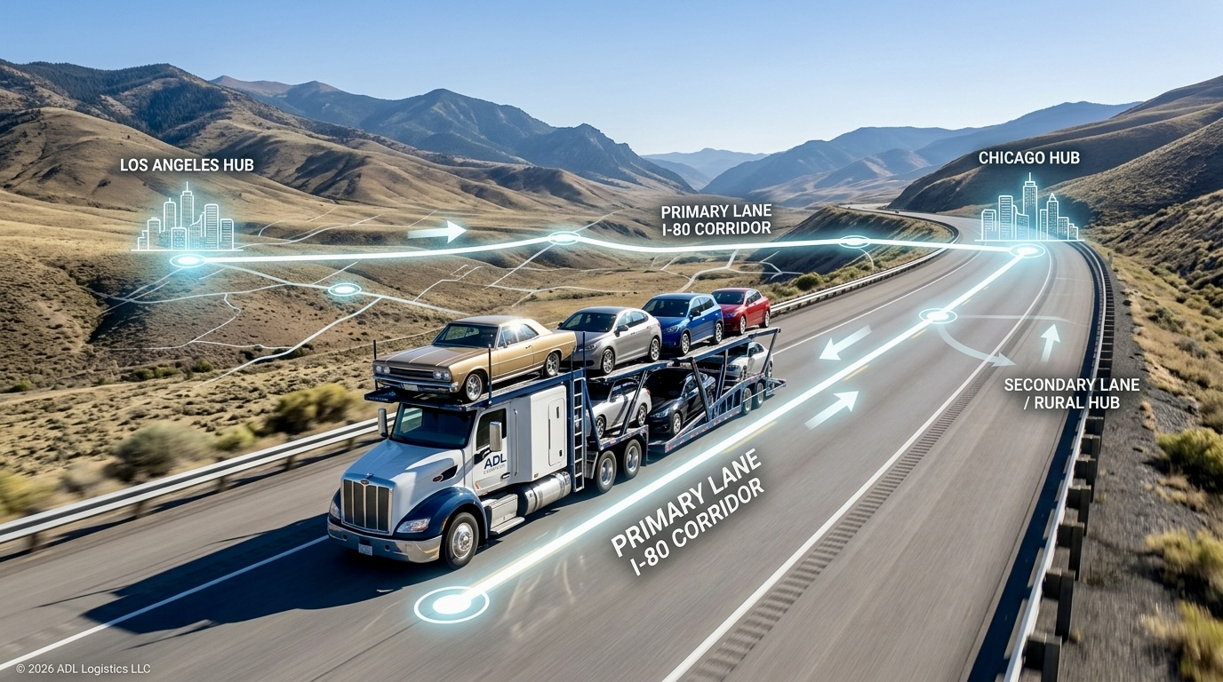
- Primary Lanes (The Interstate Corridors): Routes running along major interstates like I-95 (East Coast), I-10 (Southern Border), and I-80 (Coast-to-Coast) are considered primary lanes. Because hundreds of carriers travel these corridors every day, booking a spot is fast, and pricing remains highly competitive.
- Secondary & Rural Lanes: If your pickup or delivery location sits far off a major interstate or in a low-density rural area, it falls onto a secondary lane. Carriers must account for the extra fuel, time, and mileage required to deviate from their main path, which can impact dispatch timelines and total costs.
2. Metro Hubs and the Art of the "Deviation"
Carriers prefer moving full loads of 7 to 9 vehicles between major metropolitan hubs like Los Angeles, Dallas, Chicago, New York, and Miami. When a route connects two massive hubs, logistics run like clockwork.
If your vehicle needs to go from a small town in Oregon to a small town in Georgia, brokers typically look for a carrier moving from the Seattle/Portland hub toward the Atlanta hub. The driver will deviate slightly to pick up your vehicle along the way. Planning your move around the closest major metro area can often speed up your pickup window significantly.
3. Geographic Obstacles and Weather Patterns
Shipping routes aren't just lines on a digital grid; they are subject to real-world topography and shifting seasons. Experienced logistics brokers constantly monitor these environmental factors:
- Mountain Passes: Traversing the Rockies or the Sierra Nevada range requires specialized carrier navigation, especially during winter months when pass closures are frequent.
- Seasonal Weather: Severe weather along northern routes during winter can force carriers to divert to longer, southern lanes to ensure the safety of the cargo, shifting delivery timelines across the entire network.
4. Route Flow and Directional Demand
The direction your car travels plays a huge role in logistics. Certain routes experience high-volume "flows" at specific times of the year. For example, during late spring, the flow of vehicles out of the Sunbelt and toward the Northeast spikes dramatically.
When thousands of vehicles compete for space traveling in one direction, carriers can command higher rates. Conversely, traveling against the primary flow (e.g., shipping a car from New York to Florida in May) often unlocks incredible value because carriers are eager to fill their trailers for the return trip.
Let ADL Logistics Map Your Next Move
Navigating domestic shipping lanes requires deep market intelligence and a massive carrier network. At ADL Logistics LLC, we analyze real-time route volume, seasonal weather shifts, and carrier availability to build the most efficient plan for your vehicle transport.
Whether you are shipping along a highly traveled interstate corridor or need a vehicle picked up from a remote rural location, our logistics coordinators have you covered. Contact the ADL team today or use our online platform to get an accurate, route-optimized quote.
Written by
ADL Logistics Team
ADL Logistics — Auto Transport Specialists
Published
Jul 17, 2026
2 months ago